Upper Valley rivers expected to crest Monday evening and overnight
| Published: 07-10-2023 7:43 PM |
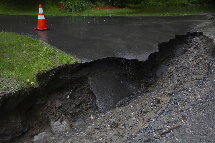
HARTFORD — Persistent rain over the last month set the stage for the dangerous flood conditions that were expected to reach their peak across the Upper Valley overnight on Monday. The deluge wiped out roads and bridges and forced the evacuation of low-lying areas.
Rainstorms that have moved across the region “almost every day for the past month,” saturated the soils in the Twin States, said Jon Palmer, a meteorologist with the National Weather Service in Gray, Maine.
“This is a large system, and the ground just can’t take any more water at this point,” Palmer said. “All the water is running off and into the streams, and just kind of piling there.”
Localized concentrations of heavy rain in Vermont have exacerbated flooding in the state.
“This storm pivoted around an axis that ultimately just put Vermont right in the center,” he said.
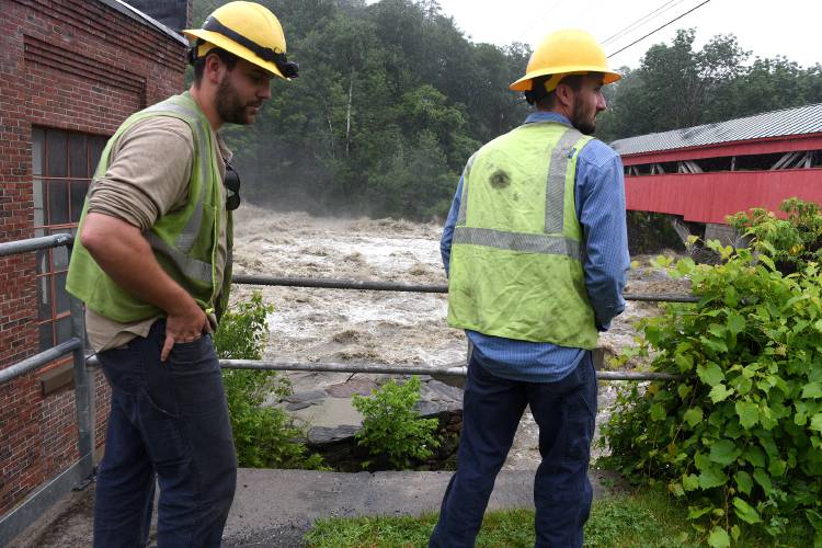
At the West Hartford monitoring station on the White River, operated by the National Oceanic and Atmospheric Administration, water levels were expected to crest around 7 p.m. at 20.4 feet, which is half a foot below major flood stage.
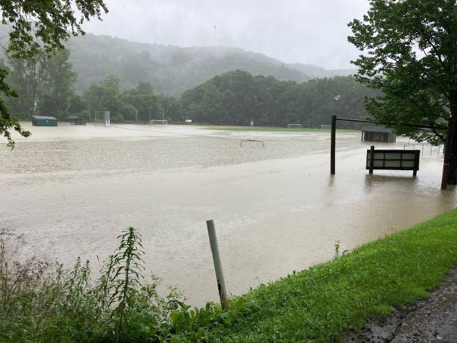
At 19 feet — which the river was supposed to reach by early evening — the National Weather Service predicts widespread flooding of fields and lowlands throughout the White River Valley, and waters will approach homes and businesses near the river.
Flash flooding is expected to continue in the Hartford area throughout this afternoon, said Adrianna Kremer, a meteorologist with the National Weather Service in Burlington.
Article continues after...
Yesterday's Most Read Articles
 Herd departs Hartford’s last remaining dairy farm
 Bald eagles are back, but great blue herons paid the price
 At Dartmouth, hundreds protest ongoing war in Gaza and express support for academic freedom
 Kenyon: What makes Dartmouth different?
 A Life: Richard Fabrizio ‘was not getting rich but was doing something that made him happy’
The Connecticut River in Lebanon and West Lebanon was expected to surpass minor flood stage overnight on Monday, and crest back down by Tuesday morning, Palmer said.
At the West Lebanon monitoring station run by the National Oceanic and Atmospheric Administration, the Connecticut River was forecasted to crest at 23 feet around midnight and stay at that level until morning. That would be the highest the Connecticut River has gotten since Tropical Storm Irene in August 2011, when the river crested at just shy of 30 feet in West Lebanon.
This is likely to cause flooding in low-lying parking lots along Route 12A in West Lebanon.
Flash flooding was expected in the area throughout Monday’s downpour and the aftermath, Palmer said.
As climate change drives temperatures up, warmer atmospheric conditions hold more water vapor. As a result, New England has experienced the largest increase in extreme precipitation events over the past quarter-century compared with anywhere else in the country, according to a study from Dartmouth scientists published in May. The study found that weather events that bring 1.5 inches or more of heavy rainfall, or melted snowfall, in one day are expected to increase 52% by the end of the century.
A weather station monitored by the federal government at the Lebanon Municipal Airport reported just over 2 inches of rain in the last 24 hours, with almost an inch of that falling in the span of six hours.
Frances Mize is a Report for America corps member. She can be reached at fmize@vnews.com or 603-727-3242.


 Big drop in tuition and aid is boosting Colby-Sawyer
  How NH Education Commissioner Frank Edelblut used his office in the culture war
