
Project would inventory Sullivan County recreation trails
| Published: 02-12-2023 10:00 PM |
CLAREMONT — Local officials are hoping to clear things up for outdoor recreation enthusiasts. Using federal funding, Sullivan County has contracted with the Upper Valley Lake Sunapee Regional Planning Commission to develop an inventory of the county’s trails, and identify gaps in location, use and other issues of accessibility.
The leaders of the project, called Sugar River Region Trails Plan, invited trail users, from skiers to ATV riders, to a public forum to introduce the effort, and to get feedback from those with their hiking boots on the ground. Roughly 20 people attended the virtual meeting last week.
“We’re trying to protect the trails for future generations,” said Tim Josephson, associate planner with the Upper Valley Lake Sunapee Regional Planning Commission, at the meeting. “Because just like any other natural resource, they’re a resource that we need to be protecting. They’re not always going to be there.”
But to begin safeguarding the trails, those involved have to know where they are. Many of the trails in the county are difficult to find, Sullivan County Manager Derek Ferland said. It might be easy to hop on the Sugar River Rail Trail, but locating trailheads that have little to no signage and iffy parking is a challenge.
“These trails are one of our biggest assets, but also one of the most poorly developed,” he said. “Do we even know what we have? Have we actually mapped everything?”
In addition to those more immediate obstacles, the conversation so far hinges on the challenges of managing a trail system that relies heavily on the access decisions of private landowners.
An avid cyclist, on pavement and on trails, Claremont resident Pascale Graham is trying to get more people “out on the roads” with her, she said at last week’s meeting.
But Graham, like many people, relies primarily on trail-finding apps such as Strava, which don’t always take into account private property.
Article continues after...
Yesterday's Most Read Articles
“Sometimes cycling in New Hampshire, I’m taking a back road in Newport and there’s like a house on it,” she said. “It turns out I’m going up someone’s driveway.”
The likelihood of bicyclists, snowmobile riders or pedestrians finding themselves on posted land is a real obstacle in a trail system that depends on landowners granting access to what otherwise would be private land.
At least 70% of public trails in Vermont and New Hampshire are on private land, according to the Upper Valley Trails Alliance.
Ferland, in an interview, said that this means the county’s trail system is an “endangered species.”
“If we just rely on what’s owned publicly we’ll have this mismatched patchwork of trails that aren’t connected to anything,” Ferland said. “I don’t know if people realize how fragile our trails are because of our reliance on private landowners, and their generosity.”
As landowners revoke and invite access, trail maps change year to year, making it difficult to inspire much public confidence in the trails’ reliability.
Also jeopardizing access is the fact that land rights are often documented in surveys and deeds, some of which are a century old.
“They’re not clear, and the information gets lost to the sands of time,” he said. “And then next thing you know someone’s built a driveway on what used to be a publicly accessible trail. Once you pave over it, it’s hard to get it back.”
The work-around, Ferland thinks, is education.
“It’s helping people see how important this is to our way of life,” he said.
It’s also teaching landowners about their protections.
New Hampshire has some of the strongest limited liability laws in the country, Russell Hirschler, executive director of the Upper Valley Trails Alliance, said at the meeting.
Some of the landowners that are resistant to opening their property in part to public use might not understand the level of protection that they have from damages.
“With the end result of this project, hopefully we’ll be able to put together a set of resources for both the landowner and the trail user to be able to create that balance,” Hirschler said.
“Not every private landowner who allows public access on their property wants to be promoted. We can do ourselves a disservice if we’re not careful about that,” he added, articulating just one of the many caveats that follow trail projects.
The negotiation between public and private property remains at center stage, but Josephson, the regional planner, thinks equilibrium is possible.
“This is a lot about balance,” he said. “Balance between old uses and new uses. Visitors and residents. Landowners and trail users.”
Those interested in providing feedback and information about trail use in Sullivan County to the Sugar River Region Trails Plan can take a survey at the following link: bit.ly/SullivanTrails.
Frances Mize is a Report for America corps member. She can be reached at fmize@vnews.com or 603-727-3242.
 Over Easy: ‘A breakfast without a newspaper is a horse without a saddle’
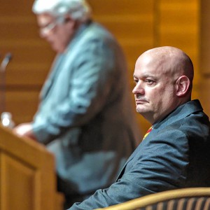 Lawsuit accuses Norwich University, former president of creating hostile environment, sex-based discrimination
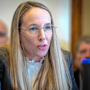 In divided decision, Senate committee votes to recommend Zoie Saunders as education secretary