Summer Guide: Explore the Mountains, Hills, Trees

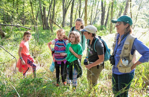
  • Hikers gather on a portion of the Cross Rivendell Trail. (Courtesy Upper Valley Trails Alliance) Upper Valley Trails Alliance photograph

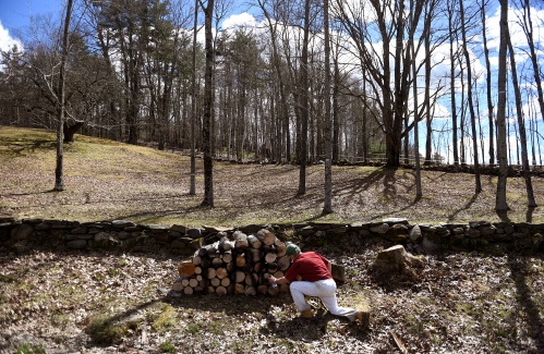
  • The Trescott Lands are located in Hanover, N.H. (Courtesy Upper Valley Trails Alliance) Upper Valley Trails Alliance photograph

  • After a short hike through the woods, a fire tower is at peak of Gile Mountain in Norwich, Vt. (Courtesy Upper Valley Trails Alliance) Upper Valley Trails Alliance photograph

  • The view from Wright’s Mountain in Bradford, Vt. (Courtesy Upper Valley Trails Alliance) Upper Valley Trails Alliance photograph

Published: 6/28/2017 11:28:29 AM
Modified: 7/5/2017 3:24:30 PM

Be it in Vermont or New Hampshire, both sides of the Upper Valley offer plum hiking opportunities. In addition to summit, family-friendly and dog-friendly hikes, this year’s guide includes lesser-known areas, trails with water features and a couple that are outside the Upper Valley but well worth the drive.

Summit Hikes

Wright’s Mountain,Bradford, Vt.

How to get there: To get to the Devil’s Den Trailhead parking, from Bradford’s only traffic light at the intersection of Routes 5 and 25, head on Route 25 West for 4 miles. Turn right onto Chase Hollow Road. Travel approximately 1.2 miles, and the parking area is on the left. To get to Wright’s Mountain Trailhead, from Bradford’s only traffic light at the intersection of Routes 5 and 25, head on Route 25 West for 5.2 miles. Turn right onto Wrights Mountain Road. Go approximately 2.4 miles to the height of land; parking area is on the right.

Good to know: The trail system is described as advanced. A rustic cabin provides shelter at Bradford’s highest point, the summit of Wright’s Mountain, with an elevation of 1,822 feet. This vantage point offers spectacular views in all seasons, and special views can be seen from various vantage points carved out on both sides of the main Wright’s Mountain Trail.

What makes it great: Take a tour through the 7-mile network of paths and old logging roads meandering around Wright’s Mountain and enjoy a wonderful view of the Waits River Valley from the summit.

Trails: At the Devil’s Den Trailhead, there is easy access to the Devil’s Den ravine and cave. The cave is best explored with a flashlight, although some natural light enters through openings between the rocks that form the “roof” of the cave. If visiting with friends, and traveling in two vehicles, leave one vehicle at the Devil’s Den Trailhead parking area and carpool around to the Wright’s Mountain Trailhead. This hike of approximately 4 miles will lead up to the cabin, then down the other side of the mountain on a foot path through a very quiet woods to a highly productive vernal pool. At that point there are two options: J. Arthur’s Trail or Ernie’s Trail to a lookout over the Devil’s Den ravine. From there, walk down and choose from two options: Take a right and enter the ravine and visit the cave; or take a left, cross a foot bridge and follow the trail to the top of a hill. From there, turn left onto Chase Hollow Trail or go a little further and take a left onto Joel’s Trail. Either one will lead down to the Devil’s Den Trailhead parking area on Chase Hollow Road.

https://www.trailfinder.info/trails/trail/wright-s-mountain-trails

South Peak,Marsh-Billings-RockefellerNational Historic Park, Woodstock

How to get there: From Woodstock go north on Route 12 for 0.6 miles. Turn right on River Road and park in the visitor parking lot (immediately on the right). The roads and trails can be accessed from the park entrance on Route 12 or from the parking lot on Prosper Road. They are open from dawn to dusk.

Good to know: There are trails for hiking, walking, snowshoeing, skiing and horseback riding, with various levels of difficulty.

What makes it great: Miles of scenic carriage roads and trails crisscross the gentle forested slopes in Woodstock. Starting at the Marsh-Billings Museum Parking Lot, follow Mountain Road to the South Peak for this 4-mile round-trip hike.

Trails: Choose from five different trails, including: Mountain Road to the Pogue to South Peak Trail; Billings Park (town of Woodstock) Faulkner Trail; Maple Trail to the Pogue; Mountain Road to Nordic Shelter; North Ridge Loop.

https://www.trailfinder.info/trails/trail/marsh-billings-rockefeller-national-historical-park

French’s Ledges, Plainfield

How to get there: From Route 120 in Meriden, turn west at the yellow flashing light onto Main Street and go 0.8 miles, over the hill past Kimball Union Academy and down to a covered bridge. Turn left onto Colby Hill Road and go through the covered bridge. North Trailhead: From the covered bridge go 0.4 miles on Colby Hill Road to a small pull-off on the left for the start of the French’s Ledges Trail. Middle Trailhead: From the covered bridge go 0.9 miles on Colby Hill Road and turn left onto Columbus Jordan Road. Parking will be on your right along Columbus Jordan Road, half a mile from its junction with Colby Hill Road. The blue-blazed Farnum Loop Trail enters the woods about 25 yards from the parking area across a mowed field to the west. On the other side of the road, to the east, is a yellow-blazed connector trail that links with the French’s Ledges Trail, bringing you to the Ledges in just over three-quarters of a mile. South Trailhead: Continue on Columbus Jordan Road to the South Trailhead where a blue-blazed trail will lead you to the Ledges.

Good to know: The moderate hike is family-friendly and dogs are welcome on the trails. The “x” intersection involving the trails So Inclined and the blue-blazed French’s Ledges Trail seems to be a confusing intersection for some trail users. If you are heading from Plainfield Elementary School up to the ledges, be careful not to diverge onto the So Inclined trail or you’ll have a much longer hike to reach your destination. Additional blazing and signing have helped with navigation in recent years.

What makes it great: There are four trailheads providing great options for both short and extended hikes to a bald top ledge providing 270-degree views of Mount Ascutney, Grantham and Croydon.

Trails: The red-blazed French’s Ledges Trail ends at the bald top of French’s Ledges, where views of Croydon and Grantham mountains, Mount Ascutney and Meriden can be seen. Yellow- and blue-blazed trails provide alternate, shorter routes up to the Ledges, while these and a number of unmarked trails allow for endless combinations of routes for exploring and exercise.

https://www.trailfinder.info/trails/trail/french-s-ledges-trails

Gile Mountain, Norwich

How to get there: From Main Street in Norwich, continue west out of the village and past Beaver Meadow Road for 0.5 miles. Turn left onto Turnpike Road and continue for 5.3 miles to the trailhead parking area on the left. While traveling on Turnpike Road, stay left at New Boston Road and Upper Turnpike Road intersections, which are located 1 and 2.7 miles from Main Street.

Good to know: The moderate hike is open to dogs, cyclists and children. The Norwich Trails Committee is currently collaborating with the Upper Valley Trails Alliance to make the trail more sustainable by rebuilding eroded and steep sections using rock steps and gravel surfacing.

What makes it great: Gile Mountain offers one of the area’s most extensive views, with a 360 degree panorama from the firetower atop. On a clear day, a half-hour walk reveals views of the White Mountains and much of the Connecticut River Valley in between. Joint trail work between the Norwich Trails Committee and the Upper Valley Trails Alliance has made this hike very accessible.

Trail: The blue-blazed multiuse trail climbs gently from the parking lot and makes a soft left onto an old flat woods road. At 0.16 miles, the trail turns right, leaving the woods road and ascending slightly. At 0.27 miles, the bike/ski trail leaves the hiking trail and veers left. The hiking trail continues straight ahead under the powerline carrying electricity from the Wilder Dam, crosses the cleared right-of-way and passes an intersection with the bike/ski trail just before entering the woods again, where it veers right to start the climb to the tower. After two switchbacks, the trail turns right at 0.6 miles to ascend the summit ridge to the fire tower, where, on a clear day, great 360-degree views of the Upper Valley can be taken in.

https://www.trailfinder.info/trails/trail/gile-mountain-trail

Family-Friendly Hikes

Montshire Museum Trails,Norwich

How to get there: The Montshire is located off Interstate 91, at Exit 13 (watch for the Museum of Science interstate sign).

Good to know: Admission to the museum is required to use the trails. The hikes are various lengths and rated easy.

What makes it great: The Montshire Museum includes 110 acres of woodland and nature trails with intriguing exhibits and vistas of the Connecticut River. If you are planning a day at the Montshire, don’t forget to save some time to hike with the kids on these trails along the Connecticut River.

Trails: Meadow Walk (0.3 miles): This short walk in the Quinn Nature Preserve borders a 2-acre meadow. The trail is surfaced with hard-packed material that allows the passage of strollers and wheelchairs. Blood Brook Trail (0.4 miles): A short walk close to Science Park passes through a sunny field, among a grove of cool, dark hemlock, and along the edge of a lagoon of the Connecticut River. Linger at an exhibit on the history of stone walls, or stop on the deck overlooking Blood Brook’s turbulent entrance into the lagoon to discover more about the natural history of salmon. River Loop Trail (0.8 mile): Beginning in Science Park, the trail travels through the tunnel and winds along the Connecticut River. Enjoy river views from several overlooks and visit Meadow Sounds Kiosk and the Migration Station along the way. A connecting trail leads to The Bluff with another view of the river. A portion of the trail is surfaced with hard-packed material that allows the passage of strollers and wheelchairs. Ridge Trail (1.0 mile): Along the way, exhibits that explore the geology and ecology of the North Woods. Planet Walk (3.0 miles roundtrip): Walk all the way from the Sun to Pluto (and back). Start the scale-model journey from the sculpture of the Sun in Science Park and encounter the inner planets (Mercury first, then Venus, then Earth and Mars), then the outer planets (Jupiter, Saturn, Uranus and Neptune). To reach tiny Pluto, be prepared for a 1.5-mile walk along the Ridge Trail and Hazen Trail. The distances are scaled to the sizes of the planet models.

https://www.trailfinder.info/trails/trail/montshire-museum-trails

Quechee State Park Trails, Quechee

How to get there: Travel about 3 miles on Route 4 from Exit 1 from Interstate 89 toward Woodstock. Turn right onto Dewey’s Mills Road after a group of restaurants and shops. This is the last road before Route 4 crosses the Ottauquechee River. At the end of the road, turn left on Quechee Main Street toward Quechee, and then take an immediate left into the Dewey’s Mills Pond parking lot just before the Quechee Inn at Marshland Farm. The distance from Route 4 is approximately 1 mile. A sign reads “Dewey’s Landing.” Alternatively, one may park at the Quechee Gorge Visitor Center on Route 4 adjacent to the gorge.

Good to know: The trail network is only 1.5 miles long.

What makes it great: This is an easy and scenic out-and-back walk that starts at the boat landing at Dewey Mills Pond.

Trail: The trail starts at the end of the parking area and follows an earthen dike that divides the pond from the Ottauquechee River. Past the dam, the trail winds along the top of Quechee Gorge. Just after passing under the Route 4 bridge, turn left on the Visitor Center connector trail to reach the Quechee Gorge Visitor Center or continue past the VC connector to reach the bottom of the gorge in about 0.5 miles. Return to the boat launch parking area the same way you started. The trail can also be made shorter by parking at the bridge or the visitor center and departing from there.

https://www.trailfinder.info/trails/trail/quechee-state-park-trails

Mink Brook Preserve, Hanover

How to get there: From Route 10 in Hanover, turn onto Brook Road. Parking is available by the trailhead on Brook Road.

Good to know: Mink Brook is an important watercourse and wetland corridor for mink, otter, muskrat, beaver, black bear and many other critters. More than 70 species of birds have also been recorded in the area. There are also more than 130 native species of herbaceous plants and over 20 species of ferns, in addition to many wildflowers.

What makes it great: This 112-acre preserve protects habitat for wild brook trout, deer, and many other creatures, while offering trails and quiet enjoyment of a peaceful place.

Trails: Wheelock Trail: A 1.25-mile moderate terrain trail along the banks of Mink Brook. Begins as a wide-open trail under a power line at Route 10. Becomes a narrow path that clings to the wooded bank above rushing Mink Brook in the Mink Brook Nature Preserve and beyond to Buck Road. Quinn Trail: A 0.75-mile easy trail from Brook Road that follows a sewer line. Steep and rough up to Route 120. Tanzi Tract Loop: A 0.3-mile easy trail visits rich native vegetation and tumbling Mink Brook. An almost level, but narrow, trail. Good for wildflowers and a view over a scenic rocky section of Mink Brook.

https://www.trailfinder.info/trails/trail/mink-brook-preserve

Dog-Friendly Hikes

Northern Rail Trail,Lebanon to Concord

How to get there:Western Terminus: Parking is available in downtown Lebanon along Taylor Street (in front of the CCBA) and in the two lots behind Lebanon City Hall. Additional parking is available near the trail gate east of Packard Hill Covered Bridge on Riverside Drive. Eastern Terminus: Park at the Hannah Dustin Park & Ride (a mile or so west from Exit 17 off I-93) and follow the ramp at the southwest corner down to the old rail line. Follow that rail line north and to the right along River Road for about a quarter of a mile where there are blue signs indicating the start of the Northern Rail Trail about 10 feet off of River Road. There is no parking at the point where the Trail starts. Parking is available at other trailheads along this route, such as Ice House Road off Route 4 (near Mobil station in Lebanon). The major trailheads are plowed and accessible in the winter.

Good to know: The Northern Rail Trail goes a total of 57 miles from Lebanon to just north of the Boscawen/Concord city line; 23 miles in Grafton County and 34 in Merrimack. Parts of it are easy, moderate and advanced. Biking, skiing, hiking, snowmobiling and horseback riding are available on different parts of the trail.

What makes it great: A nearly flat trail that travels from Lebanon, in the Mascoma River Valley, passing though historic villages and by scenic lakes, streams and hills along the old railroad bed of the Boston & Maine Railroad Northern Line, until it reaches Boscawen, a few miles north of Concord.

Trails: Eastbound from Lebanon, views include: scenic Mill Road and kayak course at twin bridges; dam at East Lebanon, a bustling sawmill village from 1780-1840; first views of Mascoma Lake; Ice House Road, site of Boston & Maine Railroad Mascoma Depot and sidings; views down lake to Shaker Bridge, built 1849 to give Enfield colony access to the railroad, of which it was a stockholder; The Cut, which has initials carved in stone date from widening in 1890s and spectacular ice formations in winter; Enfield town center; freight shed now a laundromat; depot ahead, with 1950s creamery opposite; Baltic Mill and dam, which made woolen cloth for outerwear and blankets, 1890s-1970s; Blackwater Road and Mascoma River canoe access; South Road, Crystal Lake three miles south; Indian River high bridge; Canaan town center; depot and freight house; Mirror Lake, views of Cardigan Mountain; Orange Cut, high point on Northern Line, 968 feet.

https://www.trailfinder.info/trails/trail/northern-rail-trail

Smarts Mountain, Lyme

How to get there: Take Route 10 north from Hanover into Lyme. Coming around the green in Lyme, bear right at the white church and follow signs for the Dartmouth Skiway. Pass through Lyme Center 1.8 miles from the green in Lyme, and continue winding around for 1.3 more miles to where the wide gravel Lyme-Dorchester Road forks to the left. Take this fork for 1.8 miles until, just before the iron bridge over Grant Brook, a small parking lot is reached on the left. Orange signs mark the trailheads.

Good to know: The 7.1-mile roundtrip hike is described as very difficult.

What makes it great: Smarts Mountain, at 3,240 feet, offers the closest taste of boreal forest in the Upper Valley. Standing alone and often buffeted by high winds, Smarts has a feel about it similar to the higher White Mountain peaks further north.

Trails: Two trails leave the parking area — the white-blazed Lambert Ridge Trail (Appalachian Trail) on the left, and the Ranger Trail straight ahead. For the ascent, follow the white-blazed Lambert Ridge Trail. The trail ascends quite steeply right from the beginning, with several switchbacks helping to reduce the grade. At 0.3 miles, the first major view is reached. The trail continues along the spine of Lambert Ridge for the next 1.3 miles, with frequent views. At 1.6 miles, the trail descends to the left off the last ledge of Lambert Ridge. At 2.9 miles, Smarts proper is reached. The trail begins to rise straight and steeply. At 3.5 miles, the Lambert Ridge Trail intersects with the Ranger Trail. Follow the upper Ranger Trail (also blazed in white) to the left. At 3.6 miles, a sharp switchback to the right begins the ascent of the summit ridge. At 4 miles, after several switchbacks, occasionally crossing wet ledges, the trail crests the long east-west summit ridge. At the trail junction here, a side trail leads right 0.1 miles to a tent platform and privy. At 4.1 miles, here on the summit, a fire tower affords panoramic views of the Upper Valley and the White Mountains beyond. Just past the fire tower, the old ranger cabin is maintained as a shelter for camping. To go back down from the summit, follow the Upper Ranger Trail, past the tent platform side trail, and descend to the junction with the Lambert Ridge Trail. At 0.6 miles, continue straight down the Ranger Trail (formerly the AT, and now blazed blue, when blazed at all). The trail switchbacks across rock slabs as it descends to the valley floor. At 2.0 miles, after crossing a small brook, the ruins of an old garage are on the right. The trail from here follows the old jeep road above the western bank of Grant Brook. At 3.5 miles, reach the parking lot and lower junction with the Lambert Ridge Trail.

https://www.trails.com/tcatalog_trail.aspx?trailid=HGN202-011

Bill Ballard Trail, Norwich

How to get there: Three parking areas provide access to the trail off Beaver Meadow Road in Norwich (the first left turn immediately after Dan & Whits and the Norwich Inn): the former Norwich Pool (on the left just over 1 mile from the Inn, immediately before Brigham Hill Road); Parcel 5 (1.4 miles from the old pool, and directly across Beaver Meadow Road from Brown Schoolhouse Road), and roadside parking (2.7 miles from the pool, just before Tucker Hill Road).

Good to know: The hike is described as advanced and dogs are welcome. The area includes a bike rack, picnic tables, grills, and portable toilets in season (mid-June to Labor Day). There are three benches at the junction of the trail with Brown Schoolhouse Road, approximately halfway along the trail.

What makes it great: The 4-mile Bill Ballard Trail parallels Charles Brown Brook and Beaver Meadow Road in Norwich and features the “Grand Canyon of Norwich.”

Trails: The mostly level wooded trail includes many ups and downs to cross numerous seasonal creeks that flow to Charles Brown Brook — the most spectacular creek creating the “Grand Canyon” in the upper half of the trail. From the upper (western most) end, the trail leaves the road just beyond the roadside parking area. It passes an old stone foundation before crossing a foot bridge to climb gently up into a stand of old pines. The short Converse Loop trail goes off to the right and rejoins after a short distance. The main trail crosses several foot bridges before coming to the Grand Canyon of Norwich. Follow down the rim of the canyon before crossing on stepping stones at the bottom and continuing with a flatter walk along Charles Brown Brook. The trail eventually climbs up higher in the woods again, crossing under a power line and passing an old stone wall before meeting the junction with the closed road, Brown Schoolhouse Road. Three benches here provide a good spot for a snack. The second half of the trail is much like the first, with numerous footbridges and stream crossings. The last segment follows close to the brook after descending stone steps above an old concrete dam. The trail ends at the Norwich Pool, which is currently drained due to the brook’s dam structure being heavily damaged during Tropical Storm Irene in August 2011.

https://www.trailfinder.info/trails/trail/bill-ballard-trail

Trout Pond, Lyme

How to get there: From the Lyme Center Post Office head east toward the Dartmouth Skiway and turn left onto Acorn Hill Road. Turn right onto Hardscrabble Lane after 1.7 miles. At a junction with Pony Hill Lane, continue straight ahead for a half-mile to the parking area, marked by a blue sign. The trail bears right just beyond the parking area.

Good to know: A canopy of softwoods west of the pond provides fine winter shelter for deer, while a rich wetland complex to the south is home to many birds, plants and animals. The mature eastern woods offer prime habitat for bear and turkey. Look for waterfowl on the pond.

What makes it great: Trout Pond is just beautiful and a perfect walk for families. The trail goes through a number of habitat types with a lot of wildlife. The section of trail that runs along the rocks at the edge of the pond is a great place to explore and have a snack or picnic.

Trail: The Trout Pond Forest is predominantly a mature northern hardwood forest, with pockets of softwood scattered throughout. Timber stand improvement cutting, based on a forest inventory by Ben Hudson, of Lyme, took place on parts of the tract in 1998-2000. A 200-foot buffer around the pond protects this sensitive area from disturbance. In 2001, the Conservation Commission, with a grant from the New Hampshire Department of Resources and Economic Development, prepared the parking area, re-graded the logging road and marked the trails. For an Eagle Scout project, Ian Smith led a team that rerouted part of an earlier trail to a drier, more scenic path on town land.

https://www.trailfinder.info/trails/trail/trout-pond-forest

Lesser-Known Hikes

Trescott Water Supply Lands, Hanover

How to get there: There are two trailheads. To reach the Trescott Road Trailhead, from downtown Hanover and the Green, drive east onto East Wheelock Street and up the hill 1.7 miles to the junction of East Wheelock, Grasse and Trescott roads. The Balch Hill Trailhead will be on the left. Continue straight as East Wheelock changes name to Trescott Road, and drive 1.2 more miles to the Trescott gate where the road makes a sharp bend. There is a parking area on the left (north side) with a kiosk. For the Dogford Road Trailhead, from Etna village, go north 1.1 miles on Hanover Center Road. Turn left on Dogford Road and continue 1.1 miles until the road bends to the right. There is a parking area on the left.

Good to know: The trail network is 12.3 miles long. Hike, horseback ride, ski, snowshoe or bike.

What makes it great: The Trescott Water Supply Lands feature miles of recreation trails on both maintained class VI roads and maintained trails with stunning vistas of the surrounding area. Recreational users are welcome except within 250 feet of reservoirs.

https://www.trailfinder.info/trails/trail/trescott-water-supply-lands

Paradise Park, Windsor

How to get there: From I-91 Exit 9 (Hartland), take Route 12/Route 5 south into Windsor (3.8 miles). Take a right at the traffic light onto State Street and continue 0.7 miles to County Road. Take another right on County Road toward the hospital and follow this for 0.2 miles. At the bottom of a short hill, watch for the parking area for Paradise Park on the right. Walk-in trail access is also available from Eddie’s Place and Runnemede Lane, near the Price Chopper grocery store located on Route 12/Route 5 just before the downtown area.

Good to know: No motorized vehicles are allowed in park’s 5.2-mile, moderate trail network or on water. Dogs must be leashed.

What makes it great: Paradise Park provides a lovely series of trails for hiking through mature forest, along a stream, and around the fields and shoreline adjacent to Lake Runnemede. Multiple trails can make this a very easy half-mile hike or add some loops for a 5-mile varied terrain outing.

Trails: Interesting features include a dike separating Evarts Pond and Route 5, a gazebo with views of Mount Ascutney, and a covered picnic area with fire pits and water source.

https://www.trailfinder.info/trails/trail/paradise-park

Cross Rivendell Trail,Orford to Vershire

How to get there: There are multiple trails and access points along the 36-mile route. In Orford, trails can be found on Norris Road, Baker Road, Rivendell Academy and Dame Hill Road. In Vershire, Parker Road, Chelsea Road, Vershire Center Road. In West Fairlee: Blood Brook Road, Austin Road and Middlebrook Road. In Fairlee, Lake Morey Road.

Good to know: The Cross Rivendell Trail is managed through a partnership between the Rivendell Trails Association and the Rivendell Interstate School District.

What makes it great: The Cross Rivendell Trail is a 36-mile, cross-town trail from Orford to Vershire. A good hike would be from the Bloodbrook Road trailhead to Bald Top Mountain (1.9 miles one way), where you can enjoy rolling vistas and even a view of Mount Moosilauke on a clear day.

https://www.trailfinder.info/trails/trail/cross-rivendell-trail

Hikes With Water Features

Connecticut RiverPaddlers Trail

How to get there: Access points available in dozens of Twin State towns along the Connecticut River.

Good to know: Campsites are available for free along the river.

What makes it great: The Connecticut River Paddlers Trail is a series of primitive campsites and river access points spanning 400 miles from the river’s headwaters to the Long Island Sound. New England’s longest waterway, the Connecticut River provides more than 400 miles of canoe and kayak exploration.

https://www.trailfinder.info/trails/trail/connecticut-river-paddlers-trail

Slade Brook Trail, Lyme

How to get there: Take River Road north from Route 10. The property is on the right 0.6 miles from the intersection with Route 10. Limited parking is available at the River Road trailhead.

Good to know: The Jim and Evalyn Hornig Natural Area at Lower Slade Brook is a 36-acre conservation area, offering a quiet retreat with easy walking terrain next to Slade Brook.

What makes it great: This easy wooded path follows the meandering Slade Brook up to a waterfall, one of the property’s notable features.

Trails: The easy hike is a little less than a mile long.

https://www.trailfinder.info/trails/trail/lower-slade-brook-trail

Hikes Outside The Upper Valley

Abbey Pond Trail,Middlebury, Vt.

How to get there: From the Middlebury Green, head northeast on Washington Street and then out of town on Seminary Street Extension. Bear left onto Quarry Road, then turn left at the intersection with Route116/Case Street. Travel north on Route 116 for 0.7 miles, and look for a sign for the Abbey Pond Trail on the right. Turn right onto a gravel road and follow the right spur to the trailhead parking at 0.3 miles. The land adjacent to the road and parking lot is private property. From Bristol, travel west 1.0 mile on Route 17/116. Turn left onto Route 116 at a blinking light, travel 6.9 miles and look for a sign for the Abbey Pond Trail on the left. Turn left onto a gravel road and follow the right spur to the trailhead parking at 0.3 miles. The land adjacent to the road and parking lot is private property.

Good to know: Abbey Pond supports a community of marsh plants and animals. This trail is sometimes closed to protect nesting great blue herons. Watch for the closure posters.

What makes it great: The Abbey Pond Trail is a perfect afternoon hike. This 3.6 mile round-trip hike meanders uphill, crossing three streams, before ending at the beautiful Abbey Pond and surrounding marshland.

Trail: From the parking lot, the trail leads into the woods and climbs moderately to a bridge at 0.2 miles. The trail continues beside a stream to a second stream crossing that has no bridge, but can be crossed on rocks. Ascending steadily after the second stream crossing, the trail climbs to a third stream crossing after which the terrain is gentler. The trail arrives at the outlet of Abbey Pond at 2.1 miles.

https://www.trailfinder.info/trails/trail/abbey-pond

Pine Hill Park, Rutland, Vt.

How to get there: From Route 7 turn west on Crescent Street (just north of the Route 7/Route 4 intersection, at traffic light). Turn right onto Preville Avenue right after the bridge and is a one-way street. Giorgetti Athletic complex is in front of you with the trailhead is at the west end of the parking area, at 2 Oak Street Extension.

Good to know: Trails range from easy to expert.

What makes it great: Pine Hill Park offers 16 miles of single-track trail spread over 325 acres of terrain offering some of the very best mountain biking, trail running, hiking, walking, snowshoeing, and geocaching in the central Vermont region.

Trails: Maps for the trail system can be found at the kiosk at the trailhead.

https://www.trailfinder.info/trails/trail/pine-hill-park

Correction

Photographs with this story were provided by the Upper Valley Trails Alliance. The printed version of “Summer Valley Guide” included an incorrect source for the photographs.


Sign up for our free email updates
Valley News Daily Headlines
Valley News Contests and Promotions
Valley News Extra Time
Valley News Breaking News


Valley News

24 Interchange Drive
West Lebanon, NH 03784
603-298-8711


© 2021 Valley News
Terms & Conditions - Privacy Policy